River diagram
A river is a stream of water flowing from an uphill source to reach the sea. These uphill sources can vary, from melting snow or springs of water, to rain falling in the mountains. Glaciers – hulking bodies of ice atop mountains – can also serve as a river’s source.
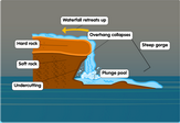
Starting from the headwaters of its source zone, water often starts its downward journey through valleys or waterfalls.
As it enters the midway point of its course, smaller streams called tributaries from other sources can feed into the main river. A river will usually have several tributaries feeding into it at various points throughout its length.
Flat, low-lying regions along a river are called floodplains. These areas are usually found near the mouth of the river. During rainy seasons or extreme weather events, the stream may overflow with excess water and drown the surrounding floodplains.
The point at which river water drains into the open sea is known as the mouth or delta due to its typically triangular shape. The riverbank, or the area lining the mouth, constantly changes due to the flow of the stream.
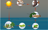
You may consult our river diagram for a highly detailed illustration of the variety of features that compose a river and its relation to the hydrologic cycle.

