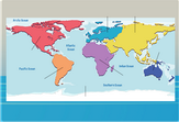
Interactive Africa map for kids
Africa is known as the hottest continent on Earth, but it isn’t made entirely out of deserts and savannahs. This landmass is home to many tropical and subtropical biomes, features wide stretches of lush rainforests, and even includes snowy areas atop its highest mountains.
Several diverse countries make up Africa. You may be familiar with plenty of them – Egypt, for example, is usually associated with the Sahara Desert. The Sahara is actually so large that it also covers Morocco, Libya, and nearly a dozen other countries. Football fans might also know about Algeria and South Africa due to the popularity of the sport.
The United Nations distinguishes five main sub regions in Africa – Northern Africa, Eastern Africa, Southern Africa, Central Africa and Western Africa. You may note that each region, including Southern Africa, is at least partly covered by the great Saharan desert.
Some of the most prominent natural features in Africa include the Nile River, which irrigates the farmland of multiple countries and acts as a trade route. The Nile is one of many rivers fed by the African Great Lakes, some of the deepest and largest lakes in the entire world.
Go ahead and try this interactive Africa map for kids as a handy and detailed resource for identifying the different nations composing this proud and lively continent.

